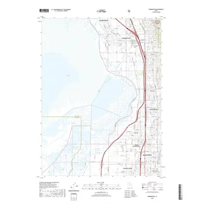
2020 Map of Farmington
USGS Topo · Published 2020About this map
Farmington Bay and the eastern edge of the Great Salt Lake define the western reaches of this Davis County landscape, where the marshy lowlands of the Old River Channel Jordan River meet the rising slopes of the Wasatch Range. The settlement pattern follows the narrow corridor between the water and the mountains, with a continuous string of communities including Kaysville, Farmington, and Bountiful. This late-modern survey captures a highly developed transportation network, featuring the Legacy Pkwy alongside recreational and historical corridors like the Santa Fe Trail, Bamberger Trail, and Canal Trail. Local history is preserved at the Farmington City Cem and the Daniel Wood Cem, while the civic centers of the region are anchored by the Davis County Court House in Farmington and its counterpart in Bountiful.
Find a feature on this map
35 named features on this map. Tap any name to fly to it.
Don’t see what you’re looking for? This feature index may not catch every label — zoom into the map to look around manually.
Map Details
Editions of this 2020 Farmington Map
This is the sole edition of this map. No revisions or reprints were ever made.
Other maps of this area

1885 · Salt Lake
USGS Topo · 1:250,000

1885 · Tooele Valley
USGS Topo · 1:250,000

1925 · Ft. Douglas
USGS Topo · 1:125,000

1928 · Ft. Douglas
USGS Topo · 1:125,000

1950 · Fort Douglas
USGS Topo · 1:24,000

1951 · Fort Douglas
USGS Topo · 1:24,000

1951 · Saltair
USGS Topo · 1:24,000

1951 · Salt Lake City North
USGS Topo · 1:24,000

1952 · Saltair NE
USGS Topo · 1:24,000

1952 · Farmington
USGS Topo · 1:24,000