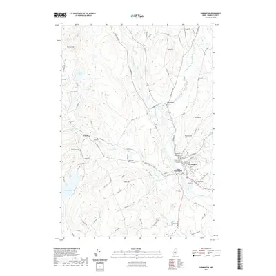
2021 Map of Farmington
USGS Topo · Published 2021About this map
Farmington serves as a prominent institutional and civic hub on the banks of the Sandy River, anchored by the University of Maine at Farmington and regional legal centers like the Franklin County Superior Court. The landscape transitions from the river valley into several significant elevations, including Porter Hill and Titcomb Hill, which overlook a network of smaller communities like West Farmington, Fairbanks, and Temple. This 2021 study documents a region deeply rooted in its local history, evidenced by a high density of family and neighborhood burial grounds such as Belcher Cem, Gay Cem, and the Red Schoolhouse Cemetery. The presence of several large water bodies, notably Varnum Pond and Staples Pond, alongside numerous named brooks like Temple Stream and Hardy Brook, suggests a landscape shaped by significant drainage systems that supported early settlement patterns and subsequent rural development.
Find a feature on this map
112 named features on this map. Tap any name to fly to it.
Don’t see what you’re looking for? This feature index may not catch every label — zoom into the map to look around manually.
Map Details
Editions of this 2021 Farmington Map
This is the sole edition of this map. No revisions or reprints were ever made.
Other maps of this area

1924 · Farmington
USGS Topo · 1:62,500

1926 · Dixfield
USGS Topo · 1:62,500

1929 · Phillips
USGS Topo · 1:48,000

1929 · Dixfield
USGS Topo · 1:62,500

1930 · Kingfield
USGS Topo · 1:48,000

1932 · Phillips
USGS Topo · 1:62,500

1932 · Kingfield
USGS Topo · 1:62,500

1950 · Lewiston
USGS Topo · 1:250,000

1956 · Dixfield
USGS Topo · 1:48,000

1956 · Farmington
USGS Topo · 1:62,500