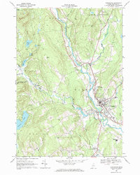
1968 Map of Farmington
USGS Topo · Published 1971About this map
The Sandy River winds through the heart of Franklin County, framing the concentrated development of Farmington and West Farmington in the late 1960s. This survey reveals the institutional layout of Farmington State College and the local Fairgrounds during a period of steady civic growth. The landscape transitions from the river valley to the prominent heights of Porter Hill and Voter Hill, where rural life is marked by numerous family and community burial grounds including Hardy Cem, Smith Cem, and the Red Schoolhouse Cem. In the village of Temple, the confluence of Temple Stream and Gus Mitchell Bk provides a focal point for the western portion of the quadrangle. Several ponds, such as Varnum Pond and Drury Pond, serve as significant water features amidst a terrain etched with gravel pits and small brooks.
Find a feature on this map
52 named features on this map. Tap any name to fly to it.
Don’t see what you’re looking for? This feature index may not catch every label — zoom into the map to look around manually.
Map Details
Editions of this 1968 Farmington Map
This is the sole edition of this map. No revisions or reprints were ever made.
Other maps of this area

1924 · Farmington
USGS Topo · 1:62,500

1926 · Dixfield
USGS Topo · 1:62,500

1929 · Phillips
USGS Topo · 1:48,000

1929 · Dixfield
USGS Topo · 1:62,500

1930 · Kingfield
USGS Topo · 1:48,000

1932 · Phillips
USGS Topo · 1:62,500

1932 · Kingfield
USGS Topo · 1:62,500

1950 · Lewiston
USGS Topo · 1:250,000

1956 · Dixfield
USGS Topo · 1:48,000

1956 · Farmington
USGS Topo · 1:62,500