
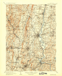
1906 Map of Farmington
USGS Topo · Published 1906About this map
The Connecticut River and Farmington River anchor this late nineteenth-century landscape, revealing a complex network of industrial mill towns and agricultural settlements at the turn of the century. The map documents critical transit corridors, including the Bissell Ferry crossing and the extensive reach of the New York New Haven and Hartford RR. While larger centers like Hartford and New Britain are visible, the map's true character is found in smaller localities such as Collinsville, Forestville, and the colorfully named Satans Kingdom.
Find a feature on this map
234 named features on this map. Tap any name to fly to it.
Don’t see what you’re looking for? This feature index may not catch every label — zoom into the map to look around manually.
Map Details
Editions of this 1906 Farmington Map
2 editions found
Other maps of this area

1886 · Springfield
USGS Topo · 1:62,500

1887 · Palmer
USGS Topo · 1:62,500

1887 · Granville
USGS Topo · 1:62,500

1888 · Sandisfield
USGS Topo · 1:62,500

1889 · Springfield
USGS Topo · 1:62,500

1889 · Derby
USGS Topo · 1:62,500

1889 · Palmer
USGS Topo · 1:62,500

1889 · Granville
USGS Topo · 1:62,500

1891 · Derby
USGS Topo · 1:62,500

1892 · Winsted
USGS Topo · 1:62,500