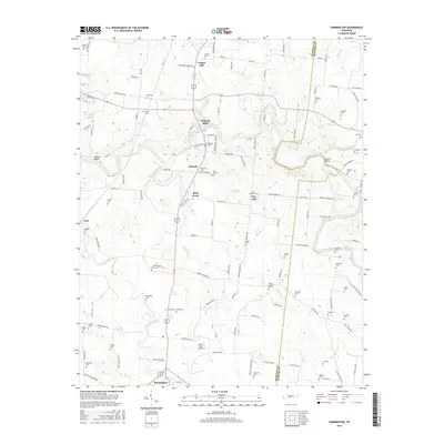
2016 Map of Farmington
USGS Topo · Published 2016About this map
Chapel Hill and Farmington anchor the northern and southern reaches of this landscape in central Tennessee, where the Duck River cuts a winding path through the valley. This 2016 survey documents a rural environment deeply connected to its agricultural and early industrial roots, evident in settlements like Wilhoite Mills and Smyrna. The map reveals a dense network of family history markers, with dozens of small cemeteries such as Swanson Cem, McQuiddy Cem, and Osteen Cem dotting the terrain. The presence of Big Spring near Farmington and the various tributaries including Opossum Cr and Spring Creek suggest a well-watered territory that has sustained these communities for generations. Infrastructure like the Rocky Acres Airport and roads like Old State Hwy 99 show the modern evolution of travel through this pocket of Marshall County.
Find a feature on this map
121 named features on this map. Tap any name to fly to it.
Don’t see what you’re looking for? This feature index may not catch every label — zoom into the map to look around manually.
Map Details
Editions of this 2016 Farmington Map
This is the sole edition of this map. No revisions or reprints were ever made.
Other maps of this area

1936 · Chapel Hill
USGS Topo · 1:24,000

1936 · Farmington
USGS Topo · 1:24,000

1936 · Rover
USGS Topo · 1:24,000

1936 · Belfast
USGS Topo · 1:24,000

1936 · Lewisburg
USGS Topo · 1:24,000

1936 · Verona
USGS Topo · 1:24,000

1936 · Rally Hill
USGS Topo · 1:24,000

1936 · Unionville
USGS Topo · 1:24,000

1936 · Bedford
USGS Topo · 1:24,000

1944 · Shelbyville
USGS Topo · 1:100,000