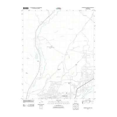
2010 Map of Farmington North
USGS Topo · Published 2010About this map
The Farmington suburbs and surrounding high desert plateaus are captured here during a period of modern expansion. The landscape is defined by the convergence of the Animas River and the La Plata River, providing vital water sources in an arid region. Extensive irrigation infrastructure, such as the Jackson Ditch, Pickering Ditch, and Star Ditch, supports the local valley while the rugged terrain of The Badlands and Hood Mesa rises to the north.
Find a feature on this map
52 named features on this map. Tap any name to fly to it.
Don’t see what you’re looking for? This feature index may not catch every label — zoom into the map to look around manually.
Map Details
Editions of this 2010 Farmington North Map
This is the sole edition of this map. No revisions or reprints were ever made.
Other maps of this area

1889 · Chaco
USGS Topo · 1:250,000

1892 · Chaco
USGS Topo · 1:250,000

1927 · Sulphur Spring
USGS Topo · 1:96,000

1928 · Kirtland
USGS Topo · 1:125,000

1932 · Kirtland
USGS Topo · 1:125,000

1954 · Shiprock
USGS Topo · 1:250,000

1958 · Shiprock
USGS Topo · 1:250,000

1959 · Shiprock
USGS Topo · 1:250,000
1963 · Farmington North
USGS Topo · 1:24,000
1963 · La Plata
USGS Topo · 1:24,000