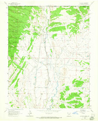
1963 Map of La Plata
USGS Topo · Published 1965About this map
Arroyo La Plata and the La Plata River form the lifeblood of this high-desert region on the border of Colorado and New Mexico. The valley is defined by an intricate network of irrigation systems such as Mefford Wall Ditch and Highland Park Ditch, which support the settlement at La Plata and the Laplata PO. To the west, the landscape rises toward Conger Mesa, carved by numerous drainages like Canyon Coalbank and Arroyo North Jones. This mid-century survey documents the transition between agricultural ranching life, seen at Two Cross Ranch, and the region's industrial footprint. Evidence of resource extraction is scattered across the terrain, from the Morgan Mines and Pratt Mine to various gravel pits and numerous gas wells. Local history is anchored by the La Plata Cem and Greenhorn Cem, while the northern boundary reaches into the Southern Ute Indian Reservation.
Find a feature on this map
64 named features on this map. Tap any name to fly to it.
Don’t see what you’re looking for? This feature index may not catch every label — zoom into the map to look around manually.
Map Details
Editions of this 1963 La Plata Map
Other maps of this area

1889 · Chaco
USGS Topo · 1:250,000

1892 · Chaco
USGS Topo · 1:250,000

1912 · Soda Canyon
USGS Topo · 1:62,500

1913 · Red Mesa
USGS Topo · 1:62,500

1915 · Soda Canyon
USGS Topo · 1:62,500

1954 · Shiprock
USGS Topo · 1:250,000

1956 · Cortez
USGS Topo · 1:250,000

1958 · Cortez
USGS Topo · 1:250,000

1958 · Shiprock
USGS Topo · 1:250,000

1959 · Shiprock
USGS Topo · 1:250,000