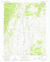
1963 Map of La Plata
USGS Topo · Published 1980About this map
La Plata and its surrounding high desert terrain appear in this detailed survey, situated just south of the Colorado and New Mexico state line. The landscape is defined by the La Plata River corridor and an extensive network of irrigation infrastructure, including the Enterprise Ditch, Pioneer Ditch, and Highland Park Ditch. These waterways reflect the region's historical reliance on managed water to support local agriculture and livestock operations like the Two Cross Ranch.
Find a feature on this map
55 named features on this map. Tap any name to fly to it.
Don’t see what you’re looking for? This feature index may not catch every label — zoom into the map to look around manually.
Map Details
Editions of this 1963 La Plata Map
Other maps of this area

1889 · Chaco
USGS Topo · 1:250,000

1892 · Chaco
USGS Topo · 1:250,000

1912 · Soda Canyon
USGS Topo · 1:62,500

1913 · Red Mesa
USGS Topo · 1:62,500

1915 · Soda Canyon
USGS Topo · 1:62,500

1954 · Shiprock
USGS Topo · 1:250,000

1956 · Cortez
USGS Topo · 1:250,000

1958 · Cortez
USGS Topo · 1:250,000

1958 · Shiprock
USGS Topo · 1:250,000

1959 · Shiprock
USGS Topo · 1:250,000