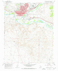
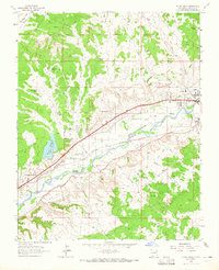
1965 Map of Farmington South
USGS Topo · Published 1969About this map
The confluence of the Animas River and San Juan River defines the landscape of Farmington during the mid-1960s. This period captures the city's residential and industrial footprint before significant late-century expansion, centered around thoroughfares like W Broadway and Main St. Local infrastructure is well-established, including the Municipal Airport and the narrow-gauge operations of the Denver and Rio Grande Western railroad.
Find a feature on this map
52 named features on this map. Tap any name to fly to it.
Don’t see what you’re looking for? This feature index may not catch every label — zoom into the map to look around manually.
Map Details
Editions of this 1965 Farmington South Map
Other maps of this area

1889 · Chaco
USGS Topo · 1:250,000

1892 · Chaco
USGS Topo · 1:250,000

1927 · Sulphur Spring
USGS Topo · 1:96,000

1928 · Kirtland
USGS Topo · 1:125,000

1932 · Kirtland
USGS Topo · 1:125,000

1954 · Shiprock
USGS Topo · 1:250,000

1958 · Shiprock
USGS Topo · 1:250,000

1959 · Shiprock
USGS Topo · 1:250,000
1963 · Farmington North
USGS Topo · 1:24,000
1963 · Flora Vista
USGS Topo · 1:24,000
Featured Places
- Farmington, NM
- Eastern Navajo Agency, NM
- Napi Headquarters, Eastern Navajo Agency
- San Juan County, NM
- United States