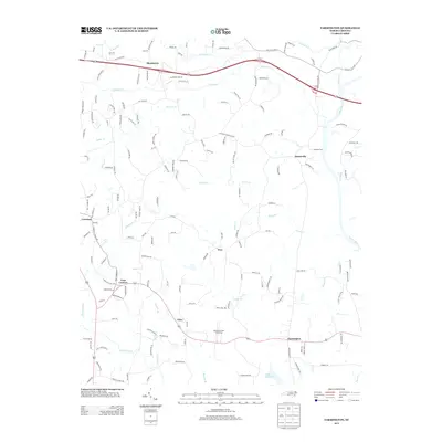
2013 Map of Farmington
USGS Topo · Published 2013About this map
Huntsville and Farmington anchor this map of the North Carolina piedmont, where the Yadkin River defines the landscape's eastern edge. The topography is shaped by a dense network of watercourses, including the N Deep Cr and S Deep Cr systems, which flow toward the Yadkin. A notable historical crossing point is found at the Shallow Ford, a site of longstanding local importance for regional transit.
Find a feature on this map
161 named features on this map. Tap any name to fly to it.
Don’t see what you’re looking for? This feature index may not catch every label — zoom into the map to look around manually.
Map Details
Editions of this 2013 Farmington Map
This is the sole edition of this map. No revisions or reprints were ever made.
Other maps of this area

1891 · Yadkinville
USGS Topo · 1:125,000

1893 · Statesville
USGS Topo · 1:125,000

1893 · Yadkinville
USGS Topo · 1:125,000

1953 · Charlotte
USGS Topo · 1:250,000

1953 · Winston-Salem
USGS Topo · 1:250,000

1954 · Charlotte
USGS Topo · 1:250,000

1955 · Winston-Salem
USGS Topo · 1:250,000

1960 · Charlotte
USGS Topo · 1:250,000

1962 · Winston-Salem
USGS Topo · 1:250,000

1962 · Charlotte
USGS Topo · 1:250,000