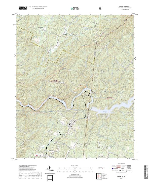
2022 Map of Farner
USGS Topo · Published 2022About this map
Ironsburg and Cataska sit within the high timberlands where the Cherokee National Forest and Nantahala National Forest meet along the Tennessee-North Carolina state line. This landscape is defined by the steep drainage of the Hiwassee River and the waters of Apalachia Lake, which occupies the deep valley below Shinbone Ridge. The settlement pattern follows the narrow winding roads through gaps like Unicoi Gap and Buck Gap, with communities such as Farner serving as local hubs for rural life. Genealogists can find several family and community burial sites, including New Zion Cem and Hamby Cem, alongside local congregations like the Farmer Presbyterian Church and Community Baptist Church. The presence of numerous named coves and flats, such as Miller Cove and Tillery Flat, reflects a long history of small-scale mountain farming and localized settlement in this corner of Polk County.
Find a feature on this map
113 named features on this map. Tap any name to fly to it.
Don’t see what you’re looking for? This feature index may not catch every label — zoom into the map to look around manually.
Map Details
Editions of this 2022 Farner Map
This is the sole edition of this map. No revisions or reprints were ever made.
Other maps of this area

1893 · Murphy
USGS Topo · 1:125,000

1914 · Murphy
USGS Topo · 1:125,000

1933 · Haw Knob
USGS Topo · 1:48,000

1933 · Bald River Falls
USGS Topo · 1:24,000

1934 · Mecca
USGS Topo · 1:24,000

1934 · Persimmon Creek
USGS Topo · 1:24,000

1934 · Unaka
USGS Topo · 1:24,000

1934 · Murphy
USGS Topo · 1:48,000

1934 · Tellico Plains
USGS Topo · 1:24,000

1935 · Tellico
USGS Topo · 1:48,000