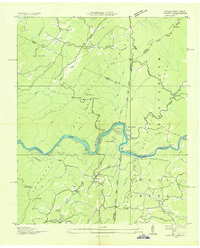
1936 Map of Farner
USGS Topo · Published 1936About this map
The Hiwassee River cuts a deep, winding path through the southern Appalachian highlands in this mid-1930s survey, a period when the Louisville and Nashville railroad served as the primary industrial artery for the region. The map documents the distinct communities of Farner, Ironsburg, and Turtletown during an era of significant transition, with the Tennessee Valley Authority and U.S. Forest Service coordinating on land management across the Cherokee National Forest and Unicoi National Forest.
Find a feature on this map
49 named features on this map. Tap any name to fly to it.
Don’t see what you’re looking for? This feature index may not catch every label — zoom into the map to look around manually.
Map Details
Editions of this 1936 Farner Map
This is the sole edition of this map. No revisions or reprints were ever made.
Other maps of this area

1893 · Murphy
USGS Topo · 1:125,000

1914 · Murphy
USGS Topo · 1:125,000

1933 · Haw Knob
USGS Topo · 1:48,000

1933 · Bald River Falls
USGS Topo · 1:24,000

1934 · Mecca
USGS Topo · 1:24,000

1934 · Persimmon Creek
USGS Topo · 1:24,000

1934 · Unaka
USGS Topo · 1:24,000

1934 · Murphy
USGS Topo · 1:48,000

1934 · Tellico Plains
USGS Topo · 1:24,000

1935 · Tellico
USGS Topo · 1:48,000