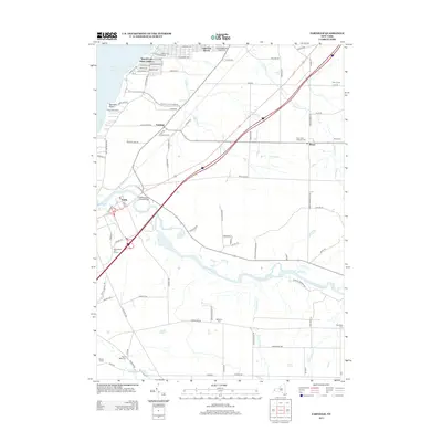
2013 Map of Farnham
USGS Topo · Published 2013About this map
The Lake Erie shoreline in southern Erie County is defined by a series of residential developments and recreation areas, including the Angola Lake Shore Addition and Lake Erie Beach. Further south, Farnham Point and Lotus Bay mark the transition toward Evangola State Park Rd and the Camp Forty Acres grounds. Inland, the villages of Farnham and Brant anchor a landscape bisected by several watercourses and infrastructure corridors. The drainage patterns are clearly visible as Muddy Cr, Delaware Cr, and the larger Cattaraugus Cr carve through the terrain toward the lake. For family historians, this map identifies several local burial grounds, such as Holy Cross Lutheran Cem, Brant Cem, and Rathburn Cem, providing essential geographic context for ancestral research in this corner of New York.
Find a feature on this map
97 named features on this map. Tap any name to fly to it.
Don’t see what you’re looking for? This feature index may not catch every label — zoom into the map to look around manually.
Map Details
Editions of this 2013 Farnham Map
This is the sole edition of this map. No revisions or reprints were ever made.
Other maps of this area

1899 · Silver Creek
USGS Topo · 1:62,500

1900 · Cherry Creek
USGS Topo · 1:62,500

1905 · Eden
USGS Topo · 1:62,500

1907 · Eden
USGS Topo · 1:62,500

1923 · Cattaraugus
USGS Topo · 1:62,500

1938 · Cattaraugus
USGS Topo · 1:62,500

1941 · Cattaraugus
USGS Topo · 1:62,500

1941 · Cherry Creek
USGS Topo · 1:62,500

1943 · Silver Creek
USGS Topo · 1:24,000

1944 · Eden
USGS Topo · 1:62,500