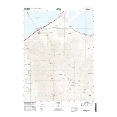
2017 Map of Farnsworth Peak
USGS Topo · Published 2017About this map
Farnsworth Peak dominates the high ground of the Oquirrh Mountains, looking out over the southeastern shores of the Great Salt Lake. This 2017 survey details the industrial and geographic transition where the mountain range meets the salt flats and water. Along the northern shoreline, recreation and landmarks like Silver Sands Beach, Sunset Beach, and the iconic Black Rock stand near the transit corridors of Garfield Junction and Lake Point Junction.
Find a feature on this map
54 named features on this map. Tap any name to fly to it.
Don’t see what you’re looking for? This feature index may not catch every label — zoom into the map to look around manually.
Map Details
Editions of this 2017 Farnsworth Peak Map
This is the sole edition of this map. No revisions or reprints were ever made.
Other maps of this area

1885 · Tooele Valley
USGS Topo · 1:250,000

1951 · Saltair
USGS Topo · 1:24,000

1952 · Magna
USGS Topo · 1:24,000

1952 · Bingham Canyon
USGS Topo · 1:24,000

1952 · Antelope Island South
USGS Topo · 1:24,000
1952 · Lark
USGS Topo · 1:24,000

1952 · Garfield
USGS Topo · 1:24,000

1953 · Tooele
USGS Topo · 1:250,000

1955 · Mills Junction
USGS Topo · 1:24,000

1955 · Tooele
USGS Topo · 1:250,000