
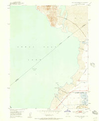
1952 Map of Antelope Island South
USGS Topo · Published 1954About this map
Saltair Resort and its iconic Roller Coaster stand as a primary focal point along the southern shoreline of the Great Salt Lake in this mid-century portrait. The map illustrates a unique landscape shaped by both recreation and industrial salt extraction, where extensive Salt Evaporators and a large Tailings Pond define the eastern flats. Transport and utility infrastructure are heavily represented, including the Garfield and Western Base Line railroad and an abandoned line of the North Pt Consolidated railway.
Find a feature on this map
24 named features on this map. Tap any name to fly to it.
Don’t see what you’re looking for? This feature index may not catch every label — zoom into the map to look around manually.
Map Details
Editions of this 1952 Antelope Island South Map
2 editions found
Other maps of this area

1885 · Tooele Valley
USGS Topo · 1:250,000

1951 · Saltair
USGS Topo · 1:24,000

1952 · Saltair NE
USGS Topo · 1:24,000

1952 · Magna
USGS Topo · 1:24,000

1952 · Garfield
USGS Topo · 1:24,000

1953 · Tooele
USGS Topo · 1:250,000

1954 · Antelope Island
USGS Topo · 1:24,000

1955 · Mills Junction
USGS Topo · 1:24,000

1955 · Tooele
USGS Topo · 1:250,000

1968 · Plug Peak SE
USGS Topo · 1:24,000