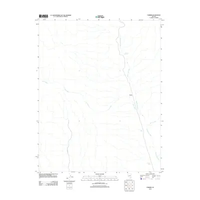
2012 Map of Farrier
USGS Topo · Published 2012About this map
Meadow Valley Wash defines the hydrological character of this Clark County landscape, serving as the primary corridor for movement through an otherwise arid environment. The map centers on the small settlement of Farrier, located at the confluence where Farrier Wash meets the main wash. This area is characterized by a network of drainage channels and ephemeral waterways, including Whitmore Wash and the deeply incised Dry Gulch. Water remains the most critical resource for any activity here, as evidenced by several localized water sources such as Lower Cone Springs, Cane Springs, and Grapevine Springs. These features indicate points of reliability for livestock or travelers navigating the desert terrain between larger regional hubs.
Find a feature on this map
8 named features on this map. Tap any name to fly to it.
Don’t see what you’re looking for? This feature index may not catch every label — zoom into the map to look around manually.
Map Details
Editions of this 2012 Farrier Map
This is the sole edition of this map. No revisions or reprints were ever made.
Other maps of this area

1886 · Saint Thomas
USGS Topo · 1:250,000

1893 · Saint Thomas
USGS Topo · 1:250,000

1954 · Las Vegas
USGS Topo · 1:250,000

1957 · Las Vegas
USGS Topo · 1:250,000

1958 · Arrow Canyon
USGS Topo · 1:62,500

1958 · Moapa
USGS Topo · 1:62,500

1959 · Las Vegas
USGS Topo · 1:250,000

1962 · Las Vegas
USGS Topo · 1:250,000

1969 · Farrier
USGS Topo · 1:24,000
1969 · Wildcat Wash NE
USGS Topo · 1:24,000