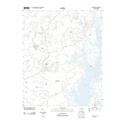
2010 Map of Farrington
USGS Topo · Published 2010About this map
B. Everett Jordan Lake dominates the eastern landscape of this quadrangle south of Chapel Hill, where the expansive water body meets a network of wooded hills and rising residential development. The 2010 terrain shows a transition from the rolling elevations of Bennett Mountain and Edwards Mountain toward the shoreline settlements of Farrington and Bells. Historically significant sites for genealogists include Manns Chapel Cemetery and Riggsbee Cemetery, which sit among a modernized road network including the Briar Chapel Pkwy. A notable landmark of modern infrastructure is the American Telephone and Telegraph Company Airport, situated near the planned community of Fearrington Village. This era represents a period of significant growth where rural Piedmont landscapes were being shaped by suburban expansion and large-scale water management projects.
Find a feature on this map
105 named features on this map. Tap any name to fly to it.
Don’t see what you’re looking for? This feature index may not catch every label — zoom into the map to look around manually.
Map Details
Editions of this 2010 Farrington Map
This is the sole edition of this map. No revisions or reprints were ever made.
Other maps of this area

1943 · Durham South
USGS Topo · 1:62,500

1946 · Chapel Hill
USGS Topo · 1:24,000

1947 · Chapel Hill
USGS Topo · 1:31,680

1951 · Farrington
USGS Topo · 1:24,000

1951 · Durham South
USGS Topo · 1:62,500

1953 · Raleigh
USGS Topo · 1:250,000

1954 · Raleigh
USGS Topo · 1:250,000

1968 · White Cross
USGS Topo · 1:24,000

1968 · Bynum
USGS Topo · 1:24,000

1969 · New Hope Dam
USGS Topo · 1:24,000