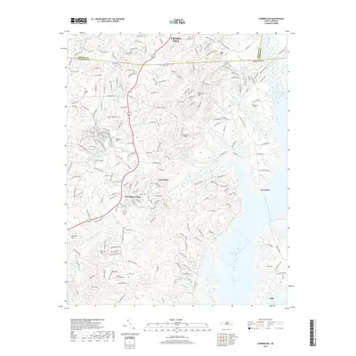
2019 Map of Farrington
USGS Topo · Published 2019About this map
B Everett Jordan Lake dominates the southeastern quadrant of this terrain where the Piedmont hills meet the lowlands of the Haw River valley. This 2019 survey captures the modern residential character of the corridor between Chapel Hill and Fearrington, showcasing established communities and newer developments like Briar Chapel. The landscape is defined by several prominent rises, including Edwards Mtn and Bennett Mtn, which separate the various drainage basins of Morgan Creek and Herndon Creek.
Find a feature on this map
209 named features on this map. Tap any name to fly to it.
Don’t see what you’re looking for? This feature index may not catch every label — zoom into the map to look around manually.
Map Details
Editions of this 2019 Farrington Map
This is the sole edition of this map. No revisions or reprints were ever made.
Other maps of this area

1943 · Durham South
USGS Topo · 1:62,500

1946 · Chapel Hill
USGS Topo · 1:24,000

1947 · Chapel Hill
USGS Topo · 1:31,680

1951 · Farrington
USGS Topo · 1:24,000

1951 · Durham South
USGS Topo · 1:62,500

1953 · Raleigh
USGS Topo · 1:250,000

1954 · Raleigh
USGS Topo · 1:250,000

1968 · White Cross
USGS Topo · 1:24,000

1968 · Bynum
USGS Topo · 1:24,000

1969 · New Hope Dam
USGS Topo · 1:24,000