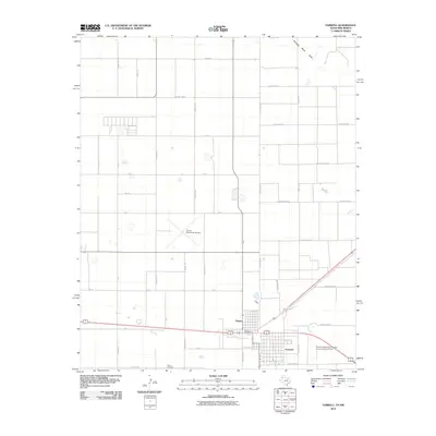
2010 Map of Farwell
USGS Topo · Published 2010About this map
Farwell and Texico anchor this borderland study, where the High Plains landscape is bisected by the rigid boundary between Texas and New Mexico. The map illustrates a classic agricultural grid system, dominated by a network of rural roads such as State Line Rd, County Rd G, and Curry Road B. The economic and logistical life of the area is centered around the transition between these two towns, with aviation playing a key role through the Clovis Municipal Airport and the specialized Farwell Spraying Service, Incorporated Airport. Cultural and community anchors are visible at the Texico Cemetery and the Texico Post Office. In the northern portion of the quadrangle, the ephemeral Running Water Draw provides a rare natural break in the otherwise strictly geometric organization of the terrain, which is primarily defined by large-scale farming and the infrastructure of the border.
Find a feature on this map
40 named features on this map. Tap any name to fly to it.
Don’t see what you’re looking for? This feature index may not catch every label — zoom into the map to look around manually.
Map Details
Editions of this 2010 Farwell Map
This is the sole edition of this map. No revisions or reprints were ever made.
Other maps of this area

1954 · Clovis
USGS Topo · 1:250,000

1957 · Clovis
USGS Topo · 1:62,500

1957 · Pleasant Hill
USGS Topo · 1:62,500

1958 · Clovis
USGS Topo · 1:250,000

1963 · Lariat
USGS Topo · 1:24,000

1963 · Oklahoma Lane
USGS Topo · 1:24,000

1965 · Bovina
USGS Topo · 1:24,000

1985 · Midway
USGS Topo · 1:24,000

1985 · Pleasure Lake
USGS Topo · 1:24,000

1985 · Muleshoe
USGS Topo · 1:100,000