
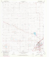
1965 Map of Bovina
USGS Topo · Published 1968About this map
Bovina serves as a critical agricultural and transportation hub in the High Plains of Parmer County during the mid-1960s. The settlement pattern is defined by its proximity to the Atchison Topeka and Santa Fe railroad, which cuts through the southeastern corner of the quadrangle. The surrounding landscape is characterized by numerous depressions and intermittent drainage systems, most notably Catfish Draw and Running Water Draw.
Find a feature on this map
11 named features on this map. Tap any name to fly to it.
Don’t see what you’re looking for? This feature index may not catch every label — zoom into the map to look around manually.
Map Details
Editions of this 1965 Bovina Map
2 editions found
Other maps of this area

1954 · Clovis
USGS Topo · 1:250,000

1957 · Clovis
USGS Topo · 1:62,500

1957 · Pleasant Hill
USGS Topo · 1:62,500

1958 · Clovis
USGS Topo · 1:250,000

1963 · Oklahoma Lane
USGS Topo · 1:24,000

1963 · Lariat NE
USGS Topo · 1:24,000

1965 · Parmerton
USGS Topo · 1:24,000

1965 · Twin Lakes
USGS Topo · 1:24,000

1965 · Rhea
USGS Topo · 1:24,000

1985 · Muleshoe
USGS Topo · 1:100,000