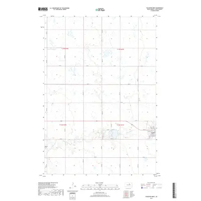
2017 Map of Faulkton West
USGS Topo · Published 2017About this map
Faulkton sits at the eastern edge of this prairie landscape, where the local street grid centers on Main St and Court St. The town's layout is bordered by Lake Faulkton to the west, a significant water body fed and drained by the meandering S Fork Snake Cr. The surrounding terrain is defined by a dense network of sectional roads, including Co Rd 6 and 160th St, which organize the vast agricultural acreage of the Missouri Coteau region. Further west, Vogeler Draw cuts through the township boundaries, illustrating the natural drainage patterns that dictate the placement of rural homesteads and transit corridors. This survey provides a clear view of the intersection between established municipal planning in the county seat and the rigid grid of the Public Land Survey System that governs the Dakotas.
Find a feature on this map
39 named features on this map. Tap any name to fly to it.
Don’t see what you’re looking for? This feature index may not catch every label — zoom into the map to look around manually.
Map Details
Editions of this 2017 Faulkton West Map
This is the sole edition of this map. No revisions or reprints were ever made.
Other maps of this area

1950 · Rezac Lake NE
USGS Topo · 1:24,000

1951 · Rezac Lake NE
USGS Topo · 1:24,000

1951 · Orient
USGS Topo · 1:24,000

1951 · Clark Lake
USGS Topo · 1:24,000

1951 · Orient NW
USGS Topo · 1:24,000

1952 · Norbeck
USGS Topo · 1:24,000

1952 · Burkmere
USGS Topo · 1:24,000

1952 · Wecota
USGS Topo · 1:24,000

1952 · Faulkton West
USGS Topo · 1:24,000

1952 · Faulkton East
USGS Topo · 1:24,000