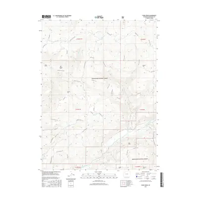
2016 Map of Fawn Creek
USGS Topo · Published 2016About this map
White River National Forest lands dominate this high-elevation terrain, where drainage systems like Fawn Creek and Moeller Creek carve through the landscape toward the North Fork White River in the south. The area is defined by its extensive trail and service road network, including the Marci Camp Trail and Beaver Ridge Trail, which provide access to remote peaks and basins. Significant topographical landmarks such as Ellison Mtn, Old Baldy, and Gobblers Knob overlook the diverse watershed. Human activity is evidenced by Marci Camp and the managed waters of Big Lick Reservoir. The complex of named gulches and basins, such as Stove Gulch and Big Beaver Basin, reflects a geography shaped by both natural erosion and forest management practices in Rio Blanco County.
Find a feature on this map
60 named features on this map. Tap any name to fly to it.
Don’t see what you’re looking for? This feature index may not catch every label — zoom into the map to look around manually.
Map Details
Editions of this 2016 Fawn Creek Map
This is the sole edition of this map. No revisions or reprints were ever made.
Other maps of this area

1906 · Grand Hogback
USGS Topo · 1:125,000

1910 · Danforth Hills
USGS Topo · 1:125,000

1910 · Grand Hogback
USGS Topo · 1:125,000

1927 · Glenwood Springs
USGS Topo · 1:125,000

1930 · Glenwood Springs
USGS Topo · 1:125,000

1954 · Craig
USGS Topo · 1:250,000

1957 · Craig
USGS Topo · 1:250,000

1957 · Leadville
USGS Topo · 1:250,000

1958 · Craig
USGS Topo · 1:250,000

1959 · Leadville
USGS Topo · 1:250,000