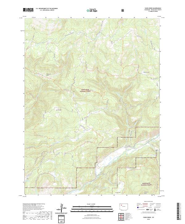
2022 Map of Fawn Creek
USGS Topo · Published 2022About this map
The White River National Forest encompasses this high-elevation landscape in Rio Blanco County, where steep drainage networks define the topography. At the southern edge of the sheet, the North Fork White River flows westward, fed by a complex system of creeks such as Fawn Cr and Cattle Cr. The terrain is marked by prominent summits including Ellison Mtn, Old Baldy, and the curiously named North Windy Bill. In the western portion, Big Lick Reservoir and the adjacent Big Licks area contrast with the high basins and parks to the east.
Find a feature on this map
65 named features on this map. Tap any name to fly to it.
Don’t see what you’re looking for? This feature index may not catch every label — zoom into the map to look around manually.
Map Details
Editions of this 2022 Fawn Creek Map
This is the sole edition of this map. No revisions or reprints were ever made.
Other maps of this area

1906 · Grand Hogback
USGS Topo · 1:125,000

1910 · Danforth Hills
USGS Topo · 1:125,000

1910 · Grand Hogback
USGS Topo · 1:125,000

1927 · Glenwood Springs
USGS Topo · 1:125,000

1930 · Glenwood Springs
USGS Topo · 1:125,000

1954 · Craig
USGS Topo · 1:250,000

1957 · Craig
USGS Topo · 1:250,000

1957 · Leadville
USGS Topo · 1:250,000

1958 · Craig
USGS Topo · 1:250,000

1959 · Leadville
USGS Topo · 1:250,000