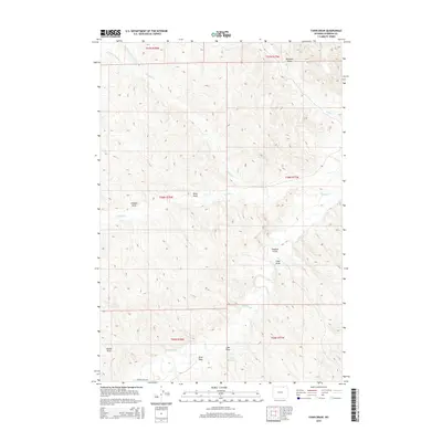
2015 Map of Fawn Draw
USGS Topo · Published 2015About this map
Buffalo Cr and its various forks carve through this section of Sheridan County, shaping a landscape dominated by complex drainage systems and ephemeral watercourses. The land is marked by deep topographic relief, where features such as Sampson Draw and Chaffee Gulch reveal the erosive power of seasonal runoff in this high plains environment. In the southern portion of the quadrangle, Clear Creek meanders through the terrain, passing near the Cultra Reservoir, a significant man-made water storage feature in an otherwise arid landscape. The only major named transportation artery is Arvada Davis Rd in the southwest, suggesting a sparsely populated area primarily defined by ranching or resource management rather than dense settlement. The map provides a detailed view of the Public Land Survey System divisions, including t56n r77w and t55n r78w, which dictate the local land ownership patterns.
Find a feature on this map
21 named features on this map. Tap any name to fly to it.
Don’t see what you’re looking for? This feature index may not catch every label — zoom into the map to look around manually.
Map Details
Editions of this 2015 Fawn Draw Map
This is the sole edition of this map. No revisions or reprints were ever made.
Other maps of this area

1955 · Sheridan
USGS Topo · 1:250,000

1958 · Sheridan
USGS Topo · 1:250,000

1962 · Sheridan
USGS Topo · 1:250,000

1971 · Cabin Creek NW
USGS Topo · 1:24,000

1971 · Cabin Creek SE
USGS Topo · 1:24,000
1971 · Cabin Creek NE
USGS Topo · 1:24,000

1971 · Arvada
USGS Topo · 1:24,000

1971 · Gardner Gulch
USGS Topo · 1:24,000
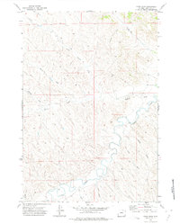
1971 · Fawn Draw
USGS Topo · 1:24,000

1971 · Leiter
USGS Topo · 1:24,000