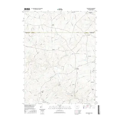
2016 Map of Fawn Grove
USGS Topo · Published 2016About this map
The Mason Dixon Rd marks the border between Pennsylvania and Maryland on this modern survey of the Piedmont hills. Centered around the borough of Fawn Grove, the landscape is a network of rural settlements and family-named roads that suggest deep ancestral roots. The area is exceptionally dense with burial grounds, including the Fellowship Cem and Heaps Cem, which serve as vital landmarks for genealogists tracking families across state lines.
Find a feature on this map
131 named features on this map. Tap any name to fly to it.
Don’t see what you’re looking for? This feature index may not catch every label — zoom into the map to look around manually.
Map Details
Editions of this 2016 Fawn Grove Map
This is the sole edition of this map. No revisions or reprints were ever made.
Other maps of this area

1900 · Parkton
USGS Topo · 1:62,500

1901 · Belair
USGS Topo · 1:62,500

1902 · Parkton
USGS Topo · 1:62,500

1908 · York
USGS Topo · 1:62,500

1910 · York
USGS Topo · 1:62,500

1912 · Mc Calls Ferry
USGS Topo · 1:62,500

1942 · Bel Air
USGS Topo · 1:62,500

1943 · Mc Calls Ferry
USGS Topo · 1:62,500

1944 · Norrisville
USGS Topo · 1:31,680
1944 · Phoenix
USGS Topo · 1:31,680