2023 Map of Fawn Grove
USGS Topo · Published 2023About this map
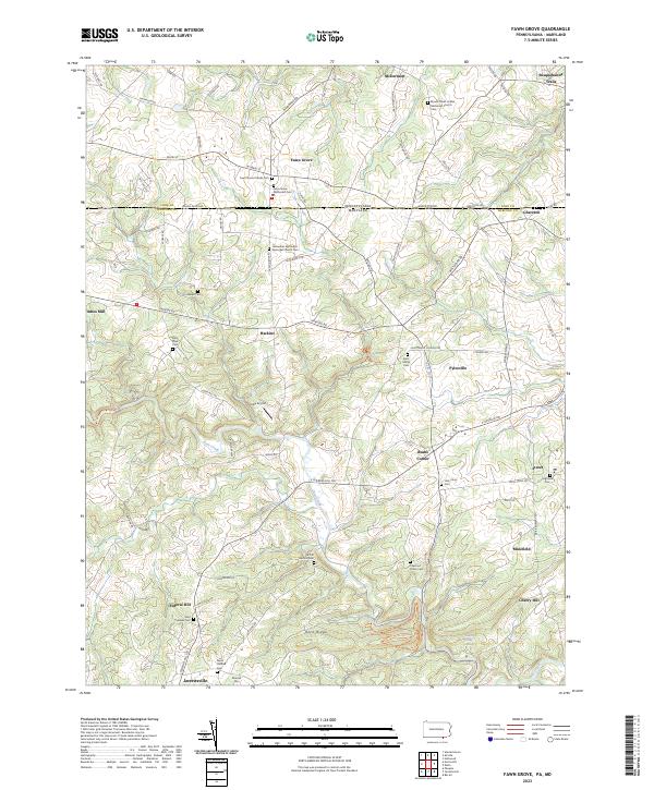
The Mason Dixon Rd marks a historic dividing line on this map, separating York Co, Pennsylvania, from Harford Co, Maryland. This borderland landscape is dotted with long-established communities like Fawn Grove, Pylesville, and Jarrettsville, reflecting a deep-seated rural settlement pattern. The concentration of religious and genealogical sites is significant, ranging from the Fawn Grove Friends Cem to the Fellowship Methodist Episcopal Church Cem, illustrating the diverse denominational history of the region. The terrain is defined by the winding course of Deer Creek as it carves through the southern portion of the sheet near Rock Ridge. Industrial and logistical heritage is evident at Amos Mill on the western edge and the small Links Airport further south, while the name Minefield suggests a legacy of local extraction in the hills east of Bushs Corner.
Find a feature on this map
83 named features on this map. Tap any name to fly to it.
Don’t see what you’re looking for? This feature index may not catch every label — zoom into the map to look around manually.
Map Details
Editions of this 2023 Fawn Grove Map
This is the sole edition of this map. No revisions or reprints were ever made.
Historical Maps of Madonna Hills Through Time
3 maps found