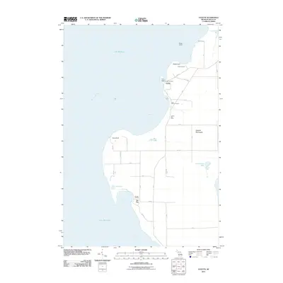
2011 Map of Fayette
USGS Topo · Published 2011About this map
Garden Peninsula stretches between the waters of Lake Michigan and Big Bay de Noc, defining the geography of this portion of Delta County. The settlement of Fayette occupies a sheltered harbor on the western shore, anchored by the Fayette Post Office and overlooking the high limestone face of Middle Bluff. This area, once a center for iron smelting, is preserved through the State Park designation, which encompasses the shoreline near Snail Shell Harbor and several historic burial grounds.
Find a feature on this map
39 named features on this map. Tap any name to fly to it.
Don’t see what you’re looking for? This feature index may not catch every label — zoom into the map to look around manually.
Map Details
Editions of this 2011 Fayette Map
This is the sole edition of this map. No revisions or reprints were ever made.
Other maps of this area

1932 · Burnt Bluff SW
USGS Topo · 1:31,680

1932 · Burnt Bluff NE
USGS Topo · 1:31,680

1932 · Burnt Bluff NW
USGS Topo · 1:31,680

1932 · Garden SE
USGS Topo · 1:31,680

1932 · Rapid River SE
USGS Topo · 1:31,680

1954 · Escanaba
USGS Topo · 1:250,000

1957 · Escanaba
USGS Topo · 1:250,000

1958 · Escanaba
USGS Topo · 1:250,000

1958 · Garden
USGS Topo · 1:62,500

1958 · Peninsula Point
USGS Topo · 1:62,500