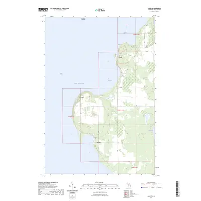
2023 Map of Fayette
USGS Topo · Published 2023About this map
Garden Peninsula rises along the eastern shore of Big Bay de Noc, where the limestone cliffs of Middle Bluff and Burnt Bluff overlook the waters of Lake Michigan. This 2023 survey documents the preservation of the era's industrial heritage within Fayette Historic State Park, centered on the sheltered waters of Snail Shell Harbor. To the south, the settlement of Sac Bay and its associated Sac Bay Cem mark a landscape shaped by both maritime activity and rural agriculture.
Find a feature on this map
44 named features on this map. Tap any name to fly to it.
Don’t see what you’re looking for? This feature index may not catch every label — zoom into the map to look around manually.
Map Details
Editions of this 2023 Fayette Map
This is the sole edition of this map. No revisions or reprints were ever made.
Other maps of this area

1932 · Burnt Bluff SW
USGS Topo · 1:31,680

1932 · Burnt Bluff NE
USGS Topo · 1:31,680

1932 · Burnt Bluff NW
USGS Topo · 1:31,680

1932 · Garden SE
USGS Topo · 1:31,680

1932 · Rapid River SE
USGS Topo · 1:31,680

1954 · Escanaba
USGS Topo · 1:250,000

1957 · Escanaba
USGS Topo · 1:250,000

1958 · Escanaba
USGS Topo · 1:250,000

1958 · Garden
USGS Topo · 1:62,500

1958 · Peninsula Point
USGS Topo · 1:62,500