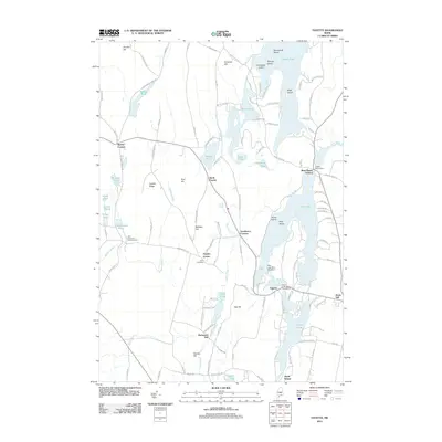
2011 Map of Fayette
USGS Topo · Published 2011About this map
Fayette and its surrounding hamlets are defined by a complex network of glacial lakes and interior ridges. This 2011 survey illustrates the concentrated settlement at Fayette Corner and the more industrial-leaning heritage of Richmond Mill along the water. The landscape is dotted with prominent elevations such as Oak Hill and Baldwin Hill, which overlook an interconnected aquatic system including Echo Lake, Pocasset Lake, and Lovejoy Pond.
Find a feature on this map
123 named features on this map. Tap any name to fly to it.
Don’t see what you’re looking for? This feature index may not catch every label — zoom into the map to look around manually.
Map Details
Editions of this 2011 Fayette Map
This is the sole edition of this map. No revisions or reprints were ever made.
Other maps of this area

1892 · Augusta
USGS Topo · 1:62,500

1894 · Norridgewock
USGS Topo · 1:62,500

1898 · Norridgewock
USGS Topo · 1:62,500

1910 · Livermore
USGS Topo · 1:62,500

1912 · Livermore
USGS Topo · 1:62,500

1924 · Farmington
USGS Topo · 1:62,500

1941 · Livermore
USGS Topo · 1:62,500

1941 · Augusta
USGS Topo · 1:62,500

1943 · Augusta
USGS Topo · 1:62,500

1943 · Norridgewock
USGS Topo · 1:62,500