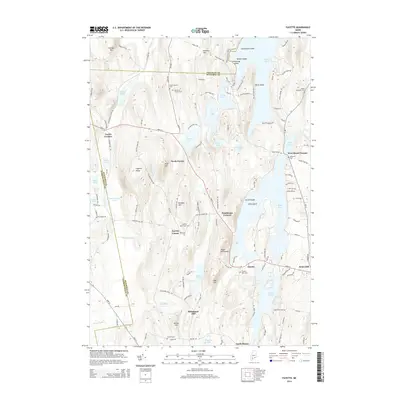
2014 Map of Fayette
USGS Topo · Published 2014About this map
Echo Lake and its large islands, Turtle Island and Echo Island, dominate the eastern landscape of this central Maine region. The area is defined by a series of north-south ridges and hills, including Fayette Ridge, Baldwin Hill, and Mount Winnebago, which separate a dense network of water bodies like David Pond, Tilton Pond, and Lovejoy Pond. Settlement patterns follow these natural corridors, with clusters of activity at Sanderson Corners, Fayette Corner, and Richmond Mill. Genealogists will find a high density of burial grounds throughout the countryside, ranging from the Old North Fayette Cem in the north to the Gordon Cem near the southern border. The map also captures the educational and social footprint of the era, noting the prominent placement of Kents Hill and local landmarks such as Oak Hill and Manter Hill.
Find a feature on this map
130 named features on this map. Tap any name to fly to it.
Don’t see what you’re looking for? This feature index may not catch every label — zoom into the map to look around manually.
Map Details
Editions of this 2014 Fayette Map
This is the sole edition of this map. No revisions or reprints were ever made.
Other maps of this area

1892 · Augusta
USGS Topo · 1:62,500

1894 · Norridgewock
USGS Topo · 1:62,500

1898 · Norridgewock
USGS Topo · 1:62,500

1910 · Livermore
USGS Topo · 1:62,500

1912 · Livermore
USGS Topo · 1:62,500

1924 · Farmington
USGS Topo · 1:62,500

1941 · Livermore
USGS Topo · 1:62,500

1941 · Augusta
USGS Topo · 1:62,500

1943 · Augusta
USGS Topo · 1:62,500

1943 · Norridgewock
USGS Topo · 1:62,500