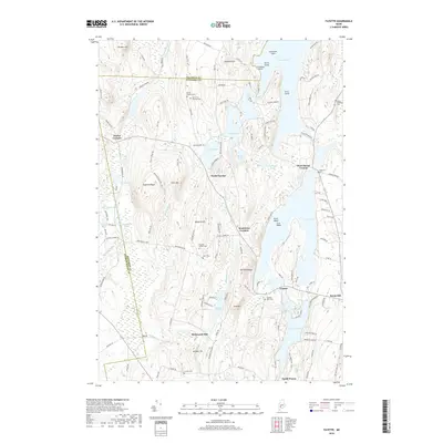
2018 Map of Fayette
USGS Topo · Published 2018About this map
Echo Lake and Parker Pond dominate this portion of the Kennebec County highlands, where the rugged terrain of the western Maine foothills is punctuated by numerous glacial ponds and significant elevation shifts. The area around Fayette and North Fayette reveals a landscape deeply connected to its rural heritage, evidenced by the high density of small family and community burial grounds such as Old North Fayette Cem and Blunt Robinson Cem. A historic industrial footprint is visible at Richmond Mill, situated south of Hales Pond. The map illustrates the convergence of three counties—Franklin, Androscoggin, and Kennebec—near the crossroads of Twelve Corners. Higher elevations like Mt Winnebago and Baldwin Hill offer a view of the complex hydrography that has shaped local settlement patterns for generations.
Find a feature on this map
130 named features on this map. Tap any name to fly to it.
Don’t see what you’re looking for? This feature index may not catch every label — zoom into the map to look around manually.
Map Details
Editions of this 2018 Fayette Map
This is the sole edition of this map. No revisions or reprints were ever made.
Other maps of this area

1892 · Augusta
USGS Topo · 1:62,500

1894 · Norridgewock
USGS Topo · 1:62,500

1898 · Norridgewock
USGS Topo · 1:62,500

1910 · Livermore
USGS Topo · 1:62,500

1912 · Livermore
USGS Topo · 1:62,500

1924 · Farmington
USGS Topo · 1:62,500

1941 · Livermore
USGS Topo · 1:62,500

1941 · Augusta
USGS Topo · 1:62,500

1943 · Augusta
USGS Topo · 1:62,500

1943 · Norridgewock
USGS Topo · 1:62,500