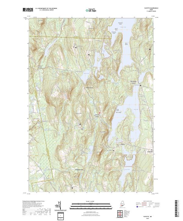
2024 Map of Fayette
USGS Topo · Published 2024About this map
Parker Pond and Echo Lake define the watery boundaries of this interior Maine landscape, where numerous smaller basins like Tilton Pond and Lovejoy Pond punctuate the wooded hills. The settlement pattern remains largely dispersed, concentrated around historic crossroads like Twelve Corners and Sanderson Corners. Genealogists will find a high density of burial sites across the township, from the centrally located Fayette Corner Cem to the Old North Fayette Cem near the northern boundary with Franklin County. These family-named cemeteries and landmarks such as Baldwin Hill and Knowles Hill reflect long-standing local ties to the land. The presence of Richmond Mill and numerous brooks, including Meadow Brook and Hales Brook, suggests a landscape historically shaped by small-scale water-powered industry and agriculture between the larger lakes.
Find a feature on this map
135 named features on this map. Tap any name to fly to it.
Don’t see what you’re looking for? This feature index may not catch every label — zoom into the map to look around manually.
Map Details
Editions of this 2024 Fayette Map
This is the sole edition of this map. No revisions or reprints were ever made.
Other maps of this area

1892 · Augusta
USGS Topo · 1:62,500

1894 · Norridgewock
USGS Topo · 1:62,500

1898 · Norridgewock
USGS Topo · 1:62,500

1910 · Livermore
USGS Topo · 1:62,500

1912 · Livermore
USGS Topo · 1:62,500

1924 · Farmington
USGS Topo · 1:62,500

1941 · Livermore
USGS Topo · 1:62,500

1941 · Augusta
USGS Topo · 1:62,500

1943 · Augusta
USGS Topo · 1:62,500

1943 · Norridgewock
USGS Topo · 1:62,500