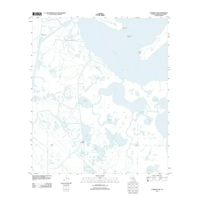
2012 Map of Fearman Lake
USGS Topo · Published 2012About this map
Vermilion Bay dominates the eastern edge of this coastal landscape, where the tides of the Gulf meet the intricate marshlands of southern Louisiana. The settlement of Belle Isle is positioned amidst a complex network of waterways, including the Belle Isle Canal and Sixmile Canal, reflecting an environment defined by transit and resource extraction. The presence of the Buck Point Gas Field and East Buck Point Gas Field near Buck Point illustrates the region's industrial role within the larger energy economy of the early 21st century. Navigable arteries like Schooner Bayou and Onemile Bayou wind through a territory of numerous small basins, including Fearman Lake, Coot Lake, and the Teal Ponds. This configuration of named points, bayous, and canals reveals the managed nature of these wetlands, where dredging and drilling have left a permanent mark alongside natural features like Mud Point and Hog Lake.
Find a feature on this map
26 named features on this map. Tap any name to fly to it.
Don’t see what you’re looking for? This feature index may not catch every label — zoom into the map to look around manually.
Map Details
Editions of this 2012 Fearman Lake Map
This is the sole edition of this map. No revisions or reprints were ever made.
Other maps of this area

1932 · Abbeville SW
USGS Topo · 1:31,680

1932 · Abbeville SE
USGS Topo · 1:31,680

1932 · Pecan Island SE
USGS Topo · 1:31,680

1945 · Pecan Island NE
USGS Topo · 1:31,680

1946 · Redfish Point SW
USGS Topo · 1:31,680

1946 · Schooner Bayou SE
USGS Topo · 1:31,680

1946 · Redfish Point NE
USGS Topo · 1:31,680

1946 · Redfish Point SE
USGS Topo · 1:31,680

1946 · Redfish Point NW
USGS Topo · 1:31,680

1951 · Pecan Island
USGS Topo · 1:62,500