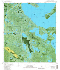
1979 Map of Fearman Lake
USGS Topo · Published 1980About this map
Paul J Rainey Wildlife Sanctuary and the State Wildlife Refuge dominate this coastal landscape in Vermilion Parish, where the transition from marsh to open water is mediated by an intricate network of natural bayous and industrial canals. This 1970s orthophotomap provides a hybrid perspective of the terrain, revealing the extensive dredging for the Freshwater Bayou Canal and the Buck Point Canal that support the region's energy sector. The aerial detail exposes the East Buck Point Gas Field and numerous offshore platforms and drill holes scattered throughout Vermilion Bay.
Find a feature on this map
45 named features on this map. Tap any name to fly to it.
Don’t see what you’re looking for? This feature index may not catch every label — zoom into the map to look around manually.
Map Details
Editions of this 1979 Fearman Lake Map
This is the sole edition of this map. No revisions or reprints were ever made.
Other maps of this area

1932 · Abbeville SW
USGS Topo · 1:31,680

1932 · Abbeville SE
USGS Topo · 1:31,680

1932 · Pecan Island SE
USGS Topo · 1:31,680

1945 · Pecan Island NE
USGS Topo · 1:31,680

1946 · Redfish Point SW
USGS Topo · 1:31,680

1946 · Schooner Bayou SE
USGS Topo · 1:31,680

1946 · Redfish Point NE
USGS Topo · 1:31,680

1946 · Redfish Point SE
USGS Topo · 1:31,680

1946 · Redfish Point NW
USGS Topo · 1:31,680

1951 · Pecan Island
USGS Topo · 1:62,500