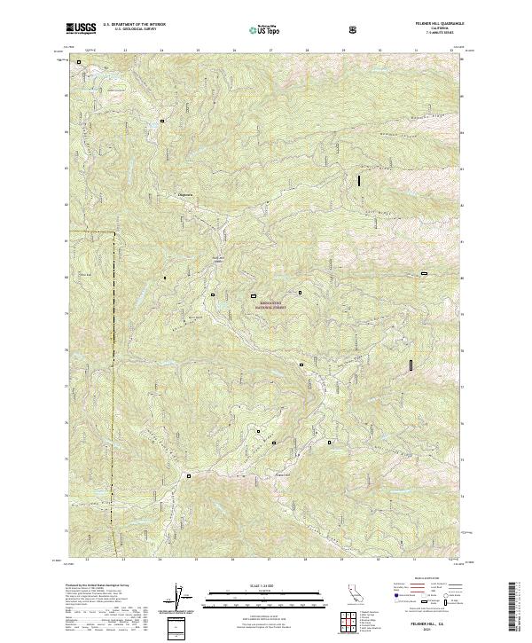
2021 Map of Felkner Hill
USGS Topo · Published 2021About this map
Mendocino National Forest defines this high-elevation landscape in Glenn County, where complex ridge systems and spring-fed canyons create a dense network of drainages. The topography is anchored by Felkner Hill and the prominent Noel Spring Ridge to the south, while the northern reaches are dominated by Bowman Ridge and Cedar Ridge. Evidence of historical activity is found at Dogtown, a point of interest connected by the winding Ivory Mill Road which traverses the Ivory Mill Saddle. This 2021 survey illustrates how the environment is shaped by water sources like Noel Spring, Jumbo Spring, and Jerusalem Spring, which feed the many branches of N Fork Elk Cr and Corbin Cr. The map provides a clear look at the intricate canyon systems such as Bowman Canyon and the named peaks like Kern Point, essential for understanding the geography of this part of the California Coast Range.
Find a feature on this map
82 named features on this map. Tap any name to fly to it.
Don’t see what you’re looking for? This feature index may not catch every label — zoom into the map to look around manually.
Map Details
Editions of this 2021 Felkner Hill Map
This is the sole edition of this map. No revisions or reprints were ever made.
Other maps of this area

1919 · Elk Creek
USGS Topo · 1:62,500

1922 · Hullville
USGS Topo · 1:62,500

1948 · Elk Creek
USGS Topo · 1:62,500

1951 · Lake Pillsbury
USGS Topo · 1:62,500

1951 · Stonyford
USGS Topo · 1:62,500

1952 · Hull Mountain
USGS Topo · 1:62,500

1957 · Elk Creek
USGS Topo · 1:62,500

1957 · Ukiah
USGS Topo · 1:250,000

1960 · Ukiah
USGS Topo · 1:250,000
1967 · Plaskett meadows
USGS Topo · 1:24,000