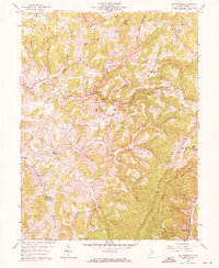
1958 Map of Fellowsville
USGS Topo · Published 1971About this map
Lyon Mines and a large strip mine at Scotch Hill define the industrial northern reaches of this Preston County landscape during the late 1950s. The region is characterized by a dense network of mountain hollows and ridges, with the towering Laurel Mountain dominating the southeastern corner. Small communities and family-named landmarks are scattered throughout the Reno and Cove districts, often centered on local institutions like Shays Chapel, Israel Ch, and Sigley Sch.
Find a feature on this map
37 named features on this map. Tap any name to fly to it.
Don’t see what you’re looking for? This feature index may not catch every label — zoom into the map to look around manually.
Map Details
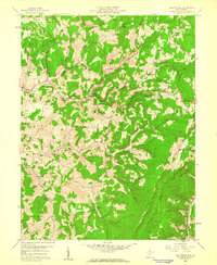
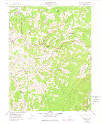
Editions of this 1958 Fellowsville Map
3 editions found
Other maps of this area

1886 · St. George
USGS Topo · 1:125,000

1891 · St. George
USGS Topo · 1:125,000

1907 · Thornton
USGS Topo · 1:62,500

1907 · Kingwood
USGS Topo · 1:62,500

1907 · Belington
USGS Topo · 1:62,500

1908 · Parsons
USGS Topo · 1:62,500

1925 · Kingwood
USGS Topo · 1:62,500

1926 · Thornton
USGS Topo · 1:62,500

1926 · Parsons
USGS Topo · 1:62,500

1927 · Belington
USGS Topo · 1:62,500