
1969 Map of Felt NE
USGS Topo · Published 1971About this map
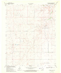
The high plains of the Oklahoma Panhandle are defined here by the open landscape of Wheeless, an area characterized by scattered ranching operations and water management in the late 1960s. Cold Springs Creek cuts through the northwest corner of the quadrangle, providing a vital natural drainage feature in this arid Cimarron County terrain. The survey reflects a period of systematic resource extraction and land use, marked by numerous Well locations across the township sections. This map captures the region's transition into modern agricultural and water conservation practices, documented through a collaboration between the U.S. Geological Survey and the Oklahoma Water Resources Board.
Find a feature on this map
4 named features on this map. Tap any name to fly to it.
Don’t see what you’re looking for? This feature index may not catch every label — zoom into the map to look around manually.
Map Details
Editions of this 1969 Felt NE Map
This is the sole edition of this map. No revisions or reprints were ever made.
Other maps of this area

1954 · Dalhart
USGS Topo · 1:250,000

1958 · Dalhart
USGS Topo · 1:250,000

1962 · Dalhart
USGS Topo · 1:250,000

1969 · Felt SW
USGS Topo · 1:24,000

1969 · Boise City NW
USGS Topo · 1:24,000

1969 · Boise City SW
USGS Topo · 1:24,000

1969 · Wheeless
USGS Topo · 1:24,000

1969 · Felt
USGS Topo · 1:24,000

1969 · Kenton SE
USGS Topo · 1:24,000
1969 · Autograph Cliff
USGS Topo · 1:24,000