
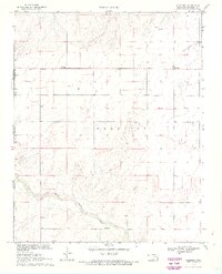
1969 Map of Wheeless
USGS Topo · Published 1971About this map
Mexhoma sits along the western edge of the Oklahoma Panhandle, just east of the New Mexico state line and south of the Colorado border. This high plains landscape is defined by the winding course of the North Canadian River and the smaller drainage of Cold Springs Creek. The settlement of Wheeless and the Mexhoma Church serve as the primary landmarks in this sparsely populated region of Cimarron County. The terrain is characterized by numerous wells, reflecting the area's agricultural and resource-based economy in the late 1960s. Surveyed as part of a cooperative effort between the Geological Survey and state conservation boards, the map documents a remote stretch of the American West where ranching and local community hubs remain central to the geography.
Find a feature on this map
10 named features on this map. Tap any name to fly to it.
Don’t see what you’re looking for? This feature index may not catch every label — zoom into the map to look around manually.
Map Details
Editions of this 1969 Wheeless Map
2 editions found
Other maps of this area

1954 · Dalhart
USGS Topo · 1:250,000

1958 · Dalhart
USGS Topo · 1:250,000

1962 · Dalhart
USGS Topo · 1:250,000

1969 · Felt SW
USGS Topo · 1:24,000

1969 · Felt
USGS Topo · 1:24,000

1969 · Felt NE
USGS Topo · 1:24,000

1969 · Kenton SE
USGS Topo · 1:24,000
1969 · Kenton SW
USGS Topo · 1:24,000

1972 · Rardin Hill
USGS Topo · 1:24,000

1972 · Moses
USGS Topo · 1:24,000