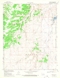
1969 Map of Kenton SW
USGS Topo · Published 1971About this map
Site of Old Fort Nichols anchors the southern reaches of this Oklahoma Panhandle landscape, marking a historical point of defense along the legendary Santa Fe Trail. In the late 1960s, this arid terrain within the Kenton and Wheeless districts is defined by the deep incisions of Tesesquite Creek and South Carrizo Creek against the high plains. The creation of Lake Carl Etling within Black Mesa State Park provides a singular water feature in a region of dry creek beds like Swede Cr. Evidence of early human occupation is noted at Basketmakers Cave No 1, highlighting the area's archaeological depth. The map reflects a sparsely populated ranching and recreational corridor near the New Mexico border, where land is still marked by original land-office meridians and primitive trails.
Find a feature on this map
21 named features on this map. Tap any name to fly to it.
Don’t see what you’re looking for? This feature index may not catch every label — zoom into the map to look around manually.
Map Details
Editions of this 1969 Kenton SW Map
This is the sole edition of this map. No revisions or reprints were ever made.
Other maps of this area

1954 · Dalhart
USGS Topo · 1:250,000

1958 · Dalhart
USGS Topo · 1:250,000

1962 · Dalhart
USGS Topo · 1:250,000

1968 · Kenton
USGS Topo · 1:24,000

1969 · Wheeless
USGS Topo · 1:24,000

1969 · Felt NE
USGS Topo · 1:24,000

1969 · Kenton SE
USGS Topo · 1:24,000
1969 · Kenton NE
USGS Topo · 1:24,000
1972 · Goodson School
USGS Topo · 1:24,000

1972 · Moses
USGS Topo · 1:24,000