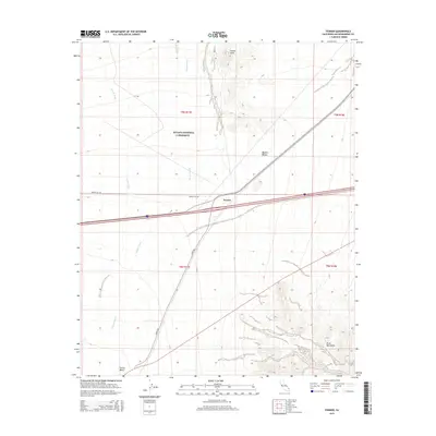
2015 Map of Fenner
USGS Topo · Published 2015About this map
Fenner sits at a junction of desert travel within the Mojave National Preserve, occupying a landscape defined by expansive drainage patterns and arid mountain ranges. This 2015 survey shows the small settlement positioned along the Interstate corridor, flanked by the Fenner Hills to the north and the jagged elevations of the Piute Mountains to the southeast. The natural geography is characterized by the broad Fenner Valley and several significant ephemeral drainage systems, most notably Woods Wash and Watson Wash, which descend through the Mojave Desert floor. Transport routes like Goffs Rd and Hidden Hill Rd provide access through this remote stretch of San Bernardino County, illustrating the modern infrastructure that overlays a terrain historically defined by its scarce water sources and harsh conditions.
Find a feature on this map
14 named features on this map. Tap any name to fly to it.
Don’t see what you’re looking for? This feature index may not catch every label — zoom into the map to look around manually.
Map Details
Editions of this 2015 Fenner Map
This is the sole edition of this map. No revisions or reprints were ever made.
Other maps of this area

1942 · Amboy
USGS Topo · 1:250,000

1943 · Amboy
USGS Topo · 1:250,000

1943 · Essex
USGS Topo · 1:62,500

1943 · Danby
USGS Topo · 1:62,500

1943 · Fenner
USGS Topo · 1:62,500

1954 · Needles
USGS Topo · 1:250,000

1956 · Needles
USGS Topo · 1:250,000

1956 · Fenner
USGS Topo · 1:62,500

1956 · Essex
USGS Topo · 1:62,500

1956 · Colton Well
USGS Topo · 1:62,500