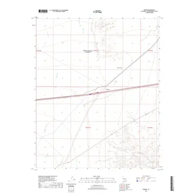
2018 Map of Fenner
USGS Topo · Published 2018About this map
Fenner sits at a critical transportation junction within the expansive Mojave Desert, where modern infrastructure bisects an ancient landscape. This 2018 survey illustrates the confluence of the Interstate 40 corridor and the historic Route 66 alignment as they pass through the wide gap between the Fenner Hills and the Piute Mountains. The map provides a detailed view of the Mojave National Preserve boundary, which encompasses the northern half of the quadrangle. Drainage patterns are defined by the ephemeral Woods Wash and Watson Wash, which underscore the arid character of the San Bernardino County high desert. For those studying the evolution of desert travel, the proximity of these dry washes to the established road networks reveals the geographic constraints that have dictated movement through this region for decades.
Find a feature on this map
13 named features on this map. Tap any name to fly to it.
Don’t see what you’re looking for? This feature index may not catch every label — zoom into the map to look around manually.
Map Details
Editions of this 2018 Fenner Map
This is the sole edition of this map. No revisions or reprints were ever made.
Other maps of this area

1942 · Amboy
USGS Topo · 1:250,000

1943 · Amboy
USGS Topo · 1:250,000

1943 · Essex
USGS Topo · 1:62,500

1943 · Danby
USGS Topo · 1:62,500

1943 · Fenner
USGS Topo · 1:62,500

1954 · Needles
USGS Topo · 1:250,000

1956 · Needles
USGS Topo · 1:250,000

1956 · Fenner
USGS Topo · 1:62,500

1956 · Essex
USGS Topo · 1:62,500

1956 · Colton Well
USGS Topo · 1:62,500