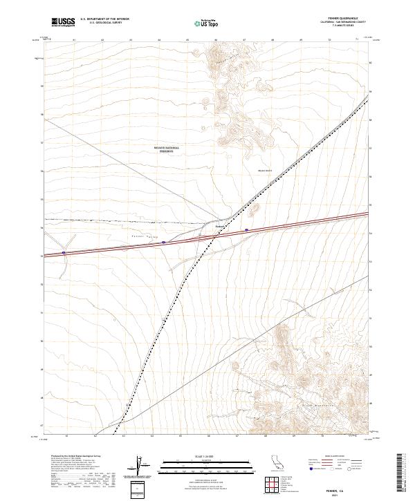
2021 Map of Fenner
USGS Topo · Published 2021About this map
Fenner sits at a critical junction of desert travel within the Mojave Desert, where historic transportation routes intersect in the expanse of San Bernardino County. The landscape is defined by the broad Fenner Valley, flanked by the rising slopes of the Fenner Hills to the north and the Piute Mountains to the southeast. Much of the northern terrain is managed as part of the Mojave National Preserve, indicating a transition from open desert to protected wilderness. Modern infrastructure follows the path of history here, as the legendary route 66 cuts across the valley floor, tracing a path that has long connected travelers across this arid portion of Southern California. The map reveals the stark contrast between the strictly organized township and range grid, such as t9n r17e, and the irregular natural contours of the surrounding high desert topography.
Find a feature on this map
12 named features on this map. Tap any name to fly to it.
Don’t see what you’re looking for? This feature index may not catch every label — zoom into the map to look around manually.
Map Details
Editions of this 2021 Fenner Map
This is the sole edition of this map. No revisions or reprints were ever made.
Other maps of this area

1942 · Amboy
USGS Topo · 1:250,000

1943 · Amboy
USGS Topo · 1:250,000

1943 · Essex
USGS Topo · 1:62,500

1943 · Danby
USGS Topo · 1:62,500

1943 · Fenner
USGS Topo · 1:62,500

1954 · Needles
USGS Topo · 1:250,000

1956 · Needles
USGS Topo · 1:250,000

1956 · Fenner
USGS Topo · 1:62,500

1956 · Essex
USGS Topo · 1:62,500

1956 · Colton Well
USGS Topo · 1:62,500