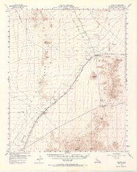
1956 Map of Fenner
USGS Topo · Published 1966About this map
The Atchison Topeka and Santa Fe Railroad bisects the high desert of the Fenner Valley in this mid-century survey. The railway defines the local economy and settlement pattern, linking the depot towns of Goffs and Fenner. At Goffs, a small community is visible with a Cem and a nearby Goffs Butte, while the surrounding terrain is marked by the traces of mining activity, including various Shafts and Prospect markings.
Find a feature on this map
22 named features on this map. Tap any name to fly to it.
Don’t see what you’re looking for? This feature index may not catch every label — zoom into the map to look around manually.
Map Details
Editions of this 1956 Fenner Map
3 editions found

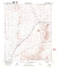
Other maps of this area

1886 · Camp Mohave
USGS Topo · 1:250,000

1892 · Camp Mohave
USGS Topo · 1:250,000

1910 · Ivanpah
USGS Topo · 1:250,000

1912 · Ivanpah
USGS Topo · 1:250,000

1926 · Mohave City
USGS Topo · 1:96,000

1942 · Camp Mohave
USGS Topo · 1:250,000

1942 · Ivanpah
USGS Topo · 1:250,000

1942 · Amboy
USGS Topo · 1:250,000

1943 · Center Hills
USGS Topo · 1:62,500

1943 · Amboy
USGS Topo · 1:250,000