1956 Map of Fenner
USGS Topo · Published 1979About this map
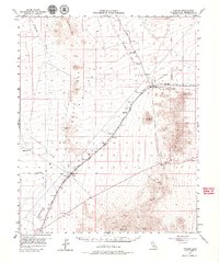
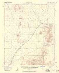
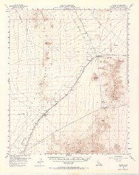
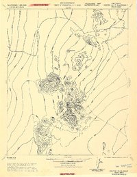
Fenner Valley and the surrounding high desert are defined by the critical transportation corridor of the Atchison Topeka and Santa Fe Railroad and the historic National Old Trails Road. This mid-century survey illustrates the importance of small railway stops like Goffs and Fenner as vital hubs in an otherwise arid expanse. Beyond the rails, the landscape is marked by the Piute Mountains and Hackberry Mtn, where prospectors left their mark with scattered Shafts, Tunnels, and Prospect sites. The presence of a Landing Strip near Watson Wash and numerous survey markers like Trigger and Fender underscores the region's role as a surveyed wilderness transition point. Localized sites like Mtn Spring Camp hint at the precious nature of water and temporary habitation in the shadow of Goffs Butte.
Find a feature on this map
26 named features on this map. Tap any name to fly to it.
Don’t see what you’re looking for? This feature index may not catch every label — zoom into the map to look around manually.
Map Details
Editions of this 1956 Fenner Map
3 editions found
Other maps of this area

1886 · Camp Mohave
USGS Topo · 1:250,000

1892 · Camp Mohave
USGS Topo · 1:250,000

1910 · Ivanpah
USGS Topo · 1:250,000

1912 · Ivanpah
USGS Topo · 1:250,000

1926 · Mohave City
USGS Topo · 1:96,000

1942 · Camp Mohave
USGS Topo · 1:250,000

1942 · Ivanpah
USGS Topo · 1:250,000

1942 · Amboy
USGS Topo · 1:250,000
1943 · Center Hills
USGS Topo · 1:62,500

1943 · Amboy
USGS Topo · 1:250,000