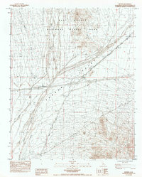
1984 Map of Fenner
USGS Topo · Published 1984About this map
The Atchison Topeka and Santa Fe railroad cuts a sharp diagonal across this arid San Bernardino County landscape, defining the primary transportation corridor through the Fenner Valley. This mid-1980s survey captures a desert environment structured by ancient drainage patterns and modern transit, where numerous labels for Wash, including the prominent Watson Wash, illustrate the hydrological reality of the region. The map shows the transition of the land into the East Mojave National Scenic Area, highlighting the conservation status of these desert reaches. Human presence is concentrated along the arterial routes, represented by the Fenner Roadside Rest and a nearby Landing Field. The terrain is punctuated by the Fenner Hills and the rugged slopes of the Piute Mts, providing a clear view of the topographic isolation characteristic of this part of the Mojave before the expansion of modern desert infrastructure.
Find a feature on this map
20 named features on this map. Tap any name to fly to it.
Don’t see what you’re looking for? This feature index may not catch every label — zoom into the map to look around manually.
Map Details
Editions of this 1984 Fenner Map
This is the sole edition of this map. No revisions or reprints were ever made.
Other maps of this area

1942 · Amboy
USGS Topo · 1:250,000

1943 · Amboy
USGS Topo · 1:250,000

1943 · Essex
USGS Topo · 1:62,500

1943 · Danby
USGS Topo · 1:62,500

1943 · Fenner
USGS Topo · 1:62,500

1954 · Needles
USGS Topo · 1:250,000

1956 · Needles
USGS Topo · 1:250,000

1956 · Fenner
USGS Topo · 1:62,500

1956 · Essex
USGS Topo · 1:62,500

1956 · Colton Well
USGS Topo · 1:62,500