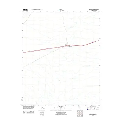
2012 Map of Fenner Spring
USGS Topo · Published 2012About this map
The Piute Mountains dominate this high desert landscape in San Bernardino County, where transportation routes and water sources dictate the geography of human activity. The modern Interstate 40 corridor follows the historical path of the National Trails Hwy, passing through the notable high point of Mountain Springs Summit. This pass has long been a critical transit point for travelers crossing the Mojave, as evidenced by the nearby Mountain Spring Camp and the presence of Mountain Springs Rd. To the southwest, the eponymous Fenner Spring sits at the base of the mountain range, representing a vital water point in an otherwise arid environment. The map also captures the junction with Goffs Rd, illustrating the sparse but essential road network that connects these remote desert points.
Find a feature on this map
7 named features on this map. Tap any name to fly to it.
Don’t see what you’re looking for? This feature index may not catch every label — zoom into the map to look around manually.
Map Details
Editions of this 2012 Fenner Spring Map
This is the sole edition of this map. No revisions or reprints were ever made.
Other maps of this area

1942 · Amboy
USGS Topo · 1:250,000

1943 · Center Hills
USGS Topo · 1:62,500

1943 · Amboy
USGS Topo · 1:250,000

1943 · Essex
USGS Topo · 1:62,500

1943 · Fenner
USGS Topo · 1:62,500

1943 · Bannock
USGS Topo · 1:62,500

1954 · Needles
USGS Topo · 1:250,000

1956 · Needles
USGS Topo · 1:250,000

1956 · Fenner
USGS Topo · 1:62,500

1956 · Essex
USGS Topo · 1:62,500