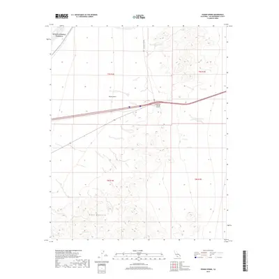
2018 Map of Fenner Spring
USGS Topo · Published 2018About this map
Fenner Spring sits at the southern edge of this landscape, tucked against the northern slopes of the Piute Mountains. This 2018 survey captures a high-desert environment where the vast expanse of the Mojave Desert meets the protected reaches of the Mojave National Preserve. Transport through this arid terrain follows established corridors, with Mountain Springs Rd cutting north towards the Mountain Springs Summit. The map illustrates the careful management of this desert ecosystem, balancing transportation needs with the preservation of natural springs and geological formations that have guided travelers through these mountains for generations.
Find a feature on this map
10 named features on this map. Tap any name to fly to it.
Don’t see what you’re looking for? This feature index may not catch every label — zoom into the map to look around manually.
Map Details
Editions of this 2018 Fenner Spring Map
This is the sole edition of this map. No revisions or reprints were ever made.
Other maps of this area

1942 · Amboy
USGS Topo · 1:250,000

1943 · Center Hills
USGS Topo · 1:62,500

1943 · Amboy
USGS Topo · 1:250,000

1943 · Essex
USGS Topo · 1:62,500

1943 · Fenner
USGS Topo · 1:62,500

1943 · Bannock
USGS Topo · 1:62,500

1954 · Needles
USGS Topo · 1:250,000

1956 · Needles
USGS Topo · 1:250,000

1956 · Fenner
USGS Topo · 1:62,500

1956 · Essex
USGS Topo · 1:62,500