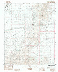
1984 Map of Fenner Spring
USGS Topo · Published 1984About this map
The Piute Mountains dominate this high-desert landscape in San Bernardino County, where the transition between the Fenner Valley and Ward Valley is defined by sharp topographic shifts and traditional travel corridors. Transit history is central here, as the Atchison Topeka and Santa Fe railroad and the National Trail Highway cut across the northwestern corner, providing a glimpse into the infrastructure that bridged the Mojave. While the area is largely defined by the protected East Mojave National Scenic Area, localized markers like Fenner Spring (Dry) and the Mountain Springs Summit indicate the vital importance of water and passage for early travelers. The presence of Goffs Road and Mountain Springs Road suggests a network of access points used by those navigating this arid environment during the mid-1980s.
Find a feature on this map
12 named features on this map. Tap any name to fly to it.
Don’t see what you’re looking for? This feature index may not catch every label — zoom into the map to look around manually.
Map Details
Editions of this 1984 Fenner Spring Map
This is the sole edition of this map. No revisions or reprints were ever made.
Other maps of this area

1942 · Amboy
USGS Topo · 1:250,000

1943 · Center Hills
USGS Topo · 1:62,500

1943 · Amboy
USGS Topo · 1:250,000

1943 · Essex
USGS Topo · 1:62,500

1943 · Fenner
USGS Topo · 1:62,500

1943 · Bannock
USGS Topo · 1:62,500

1954 · Needles
USGS Topo · 1:250,000

1956 · Needles
USGS Topo · 1:250,000

1956 · Fenner
USGS Topo · 1:62,500

1956 · Essex
USGS Topo · 1:62,500