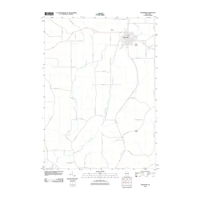
2010 Map of Fennimore
USGS Topo · Published 2010About this map
Fennimore serves as the primary hub of this 2010 survey, situated amidst the high agricultural lands of Grant County. The town's grid is flanked by the Stupek Farms Airport to the east and the Prairie Cemetery to the northwest. Outside the municipal limits, the landscape transitions into a network of ridges and coulees, defined by drainage patterns like the Borah Creek and Rogers Branch. Small settlements such as Liberty Ridge in the southeast reflect the rural character of the region. The topography is further marked by family-named infrastructure, including Mount Ridge Rd and Roger Hollow Rd, which trace the difficult elevation of the terrain. The presence of the Grant River in the southwest corner and the Big Green River to the north underscores the importance of the watershed in shaping the local economy and road network.
Find a feature on this map
44 named features on this map. Tap any name to fly to it.
Don’t see what you’re looking for? This feature index may not catch every label — zoom into the map to look around manually.
Map Details
Editions of this 2010 Fennimore Map
This is the sole edition of this map. No revisions or reprints were ever made.
Other maps of this area

1900 · Lancaster
USGS Topo · 1:125,000

1904 · Lancaster
USGS Topo · 1:125,000

1908 · Lancaster
USGS Topo · 1:125,000

1926 · Wauzeka
USGS Topo · 1:62,500

1933 · Boscobel
USGS Topo · 1:62,500

1958 · La Crosse
USGS Topo · 1:250,000

1959 · Dubuque
USGS Topo · 1:250,000

1961 · Dubuque
USGS Topo · 1:250,000

1961 · La Crosse
USGS Topo · 1:250,000

1962 · Dubuque
USGS Topo · 1:250,000