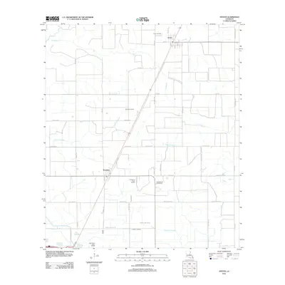
2012 Map of Fenton
USGS Topo · Published 2012About this map
Fenton and Woodlawn anchor this landscape of Jefferson Davis Parish and Calcasieu Parish as it appeared in 2012. The area is defined by a dense network of energy production and agricultural drainage, with the Fenton Gas Field and Woodlawn Oil Field indicating the persistent importance of the petroleum industry to the local economy. Waterways like Bayou Arceneaux, Little Bayou, and W Bayou Lacassine meander through a grid of rural roads, many named for local families such as Abie Fontenot Rd and Leger Rd. The presence of the Lonesome Dove Airfield and Light Plane Flyers Airfield suggests a community where private aviation and perhaps crop-dusting are central to land management. For those tracing family history, the Pine Hill Cem on Pinehill Cemetery Rd serves as a significant genealogical landmark in this coastal prairie region.
Find a feature on this map
43 named features on this map. Tap any name to fly to it.
Don’t see what you’re looking for? This feature index may not catch every label — zoom into the map to look around manually.
Map Details
Editions of this 2012 Fenton Map
This is the sole edition of this map. No revisions or reprints were ever made.
Other maps of this area

1932 · Lake Charles NE
USGS Topo · 1:31,680

1942 · Lake Charles
USGS Topo · 1:62,500

1946 · Lacassine
USGS Topo · 1:31,680

1947 · Kinder
USGS Topo · 1:31,680

1947 · Fenton
USGS Topo · 1:31,680

1947 · Hecker
USGS Topo · 1:31,680

1947 · Pine Island
USGS Topo · 1:31,680

1947 · Welsh
USGS Topo · 1:31,680

1947 · Edna
USGS Topo · 1:31,680

1947 · Thompson Bluff
USGS Topo · 1:31,680